Bridging the boundaries of Sunset Boulevard in Los Angeles
#PhysicalDesign
#AI
#DesignComputation
#ClimateChange
Instructor
Charles Waldheim (Harvard GSD)
Team
Individual
Tool
RunwayML, Rhino, Grasshopper, Adobe Illustrator / Photoshop / After Effects

PROJECT CONTEXT & PROBLEM SPACE
Los Angeles has severe shade disparities, being caused by many intertwined factors: the original prefection of sunlight, the lack of trees, wealth disparities, racial inequity, and more. While climate change is happening, the raising temperature has urged us to take actions to seek for ways of adding shades.
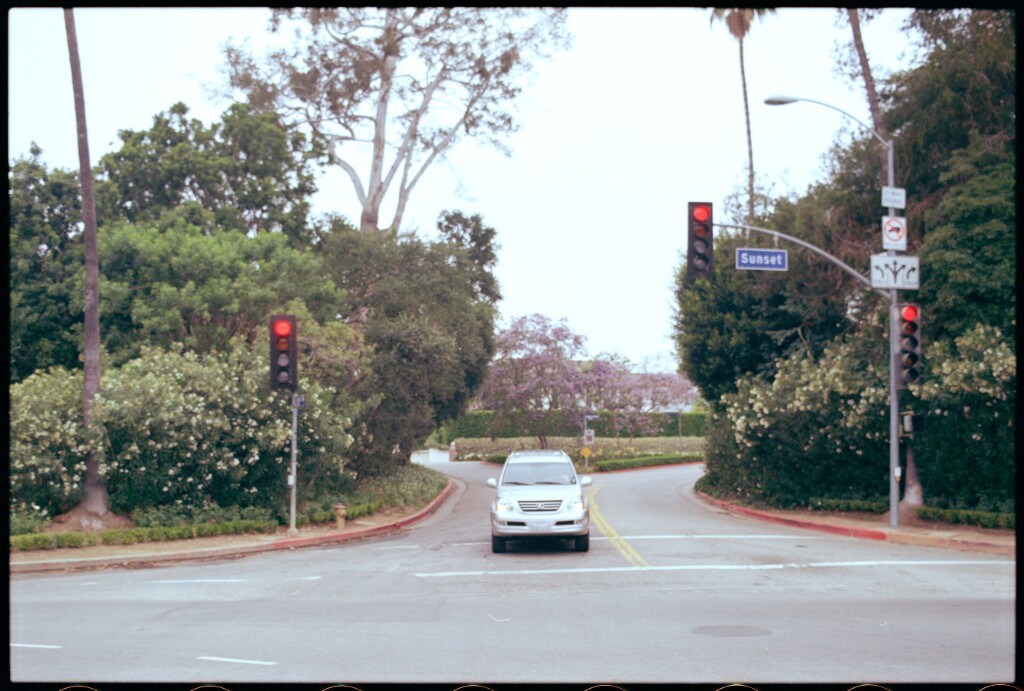
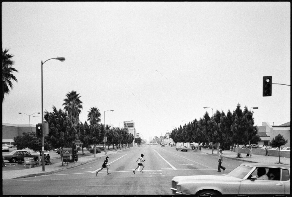
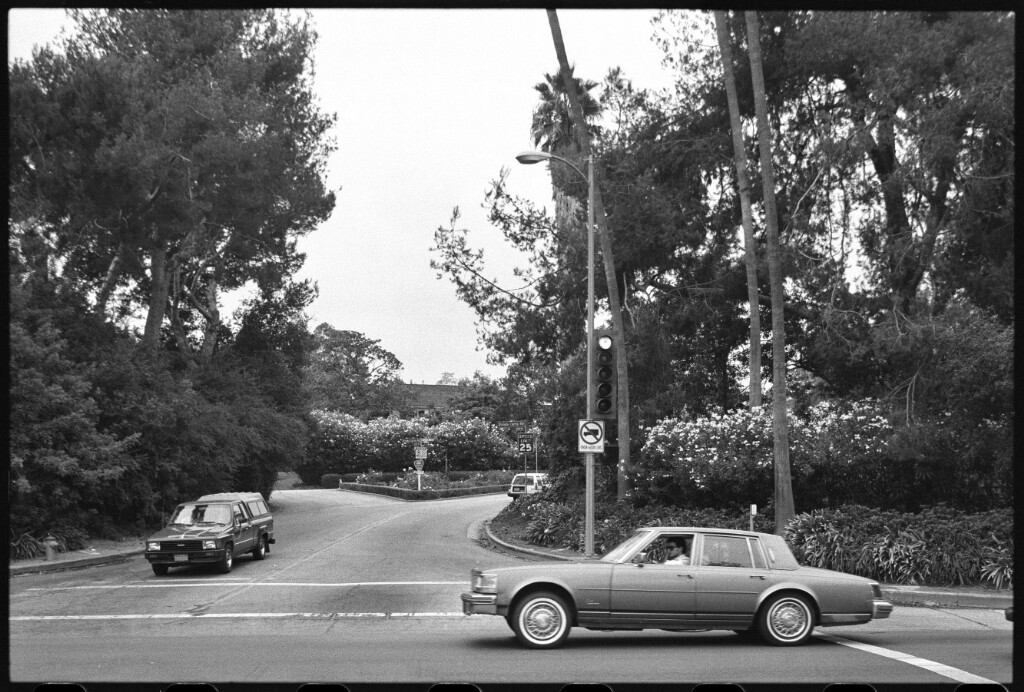
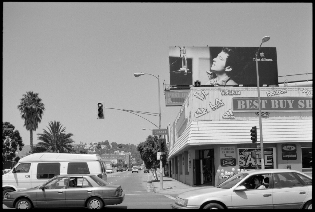
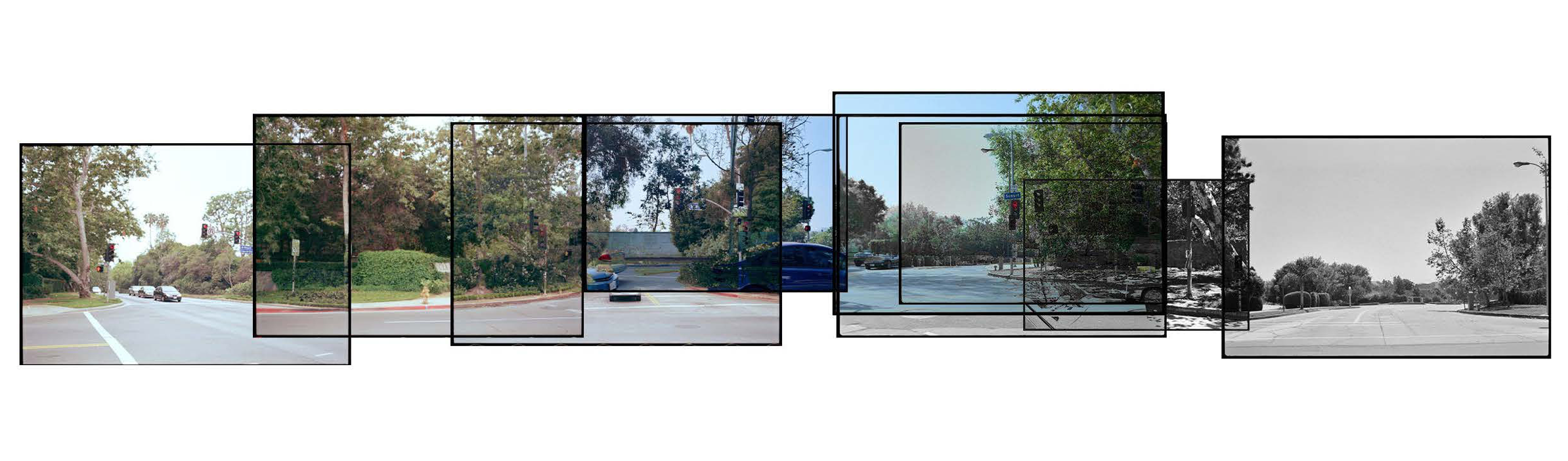
The studio takes Ed Ruscha’s photo collection documenting LA’s famous street, Sunset BLVD, as the database to study the evolvement of streetscape of LA. As we take Ruscha’s photos as our starting point, potential spatial qualities for shades are analyzed and implemented through machine learning and other computational methods. The experiment of machine hallucination creates novel possibilities and opens up the interesting discussion on the potential future for spatial design.
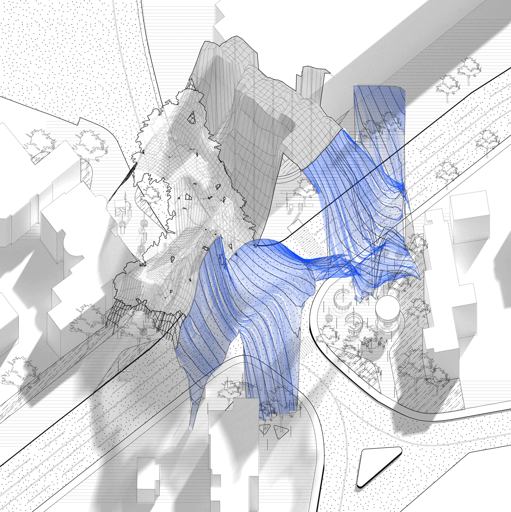
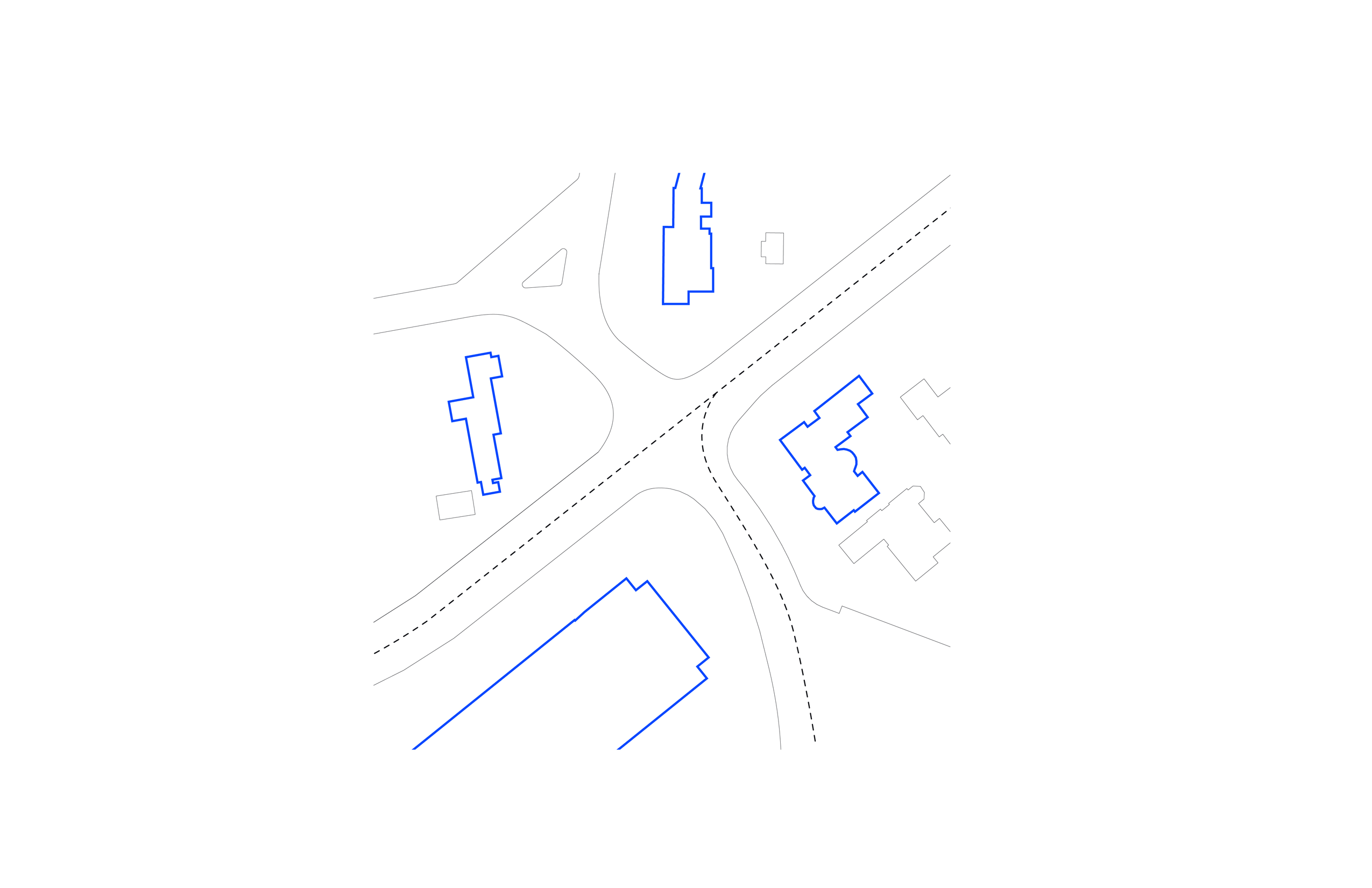
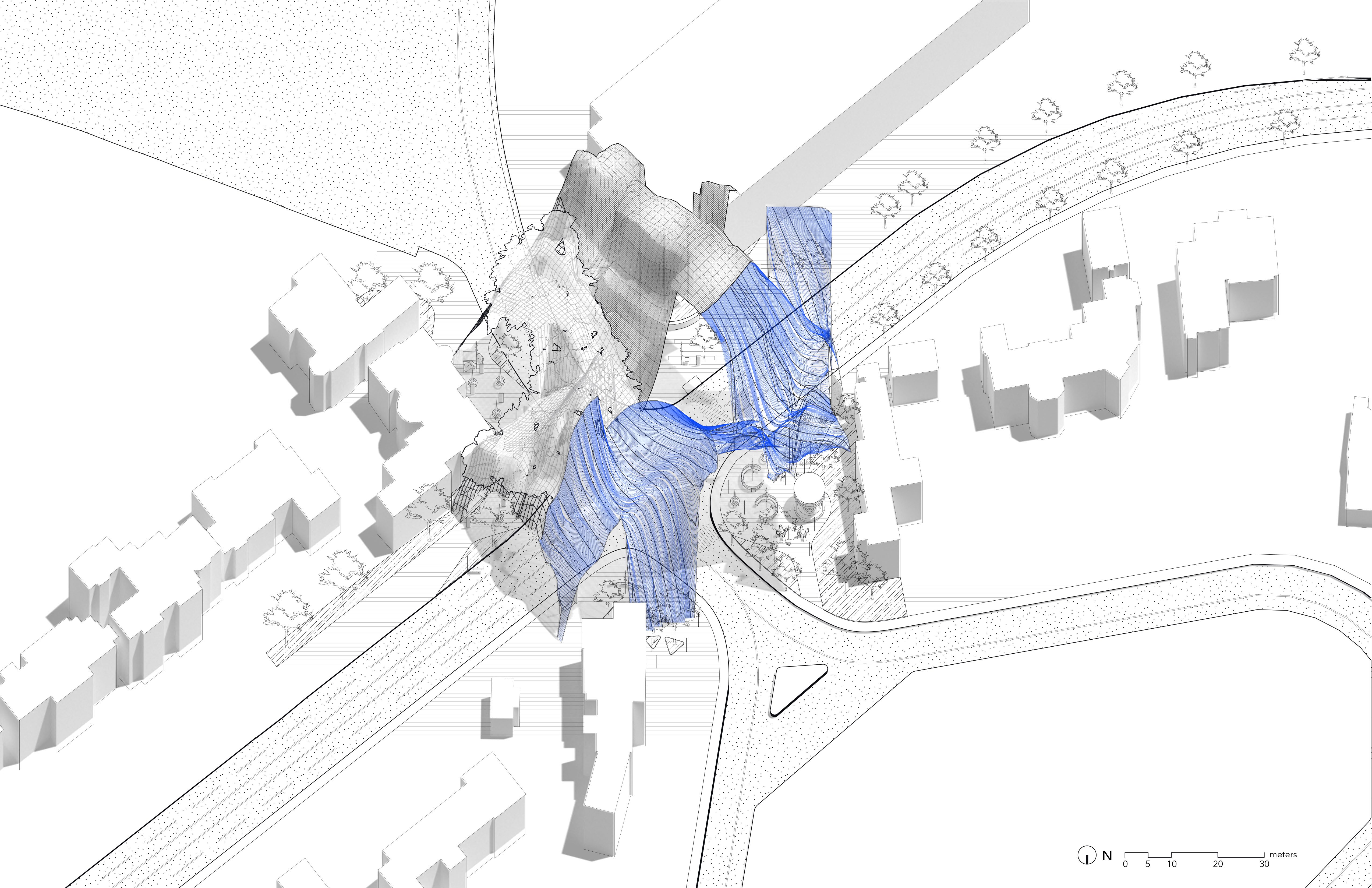
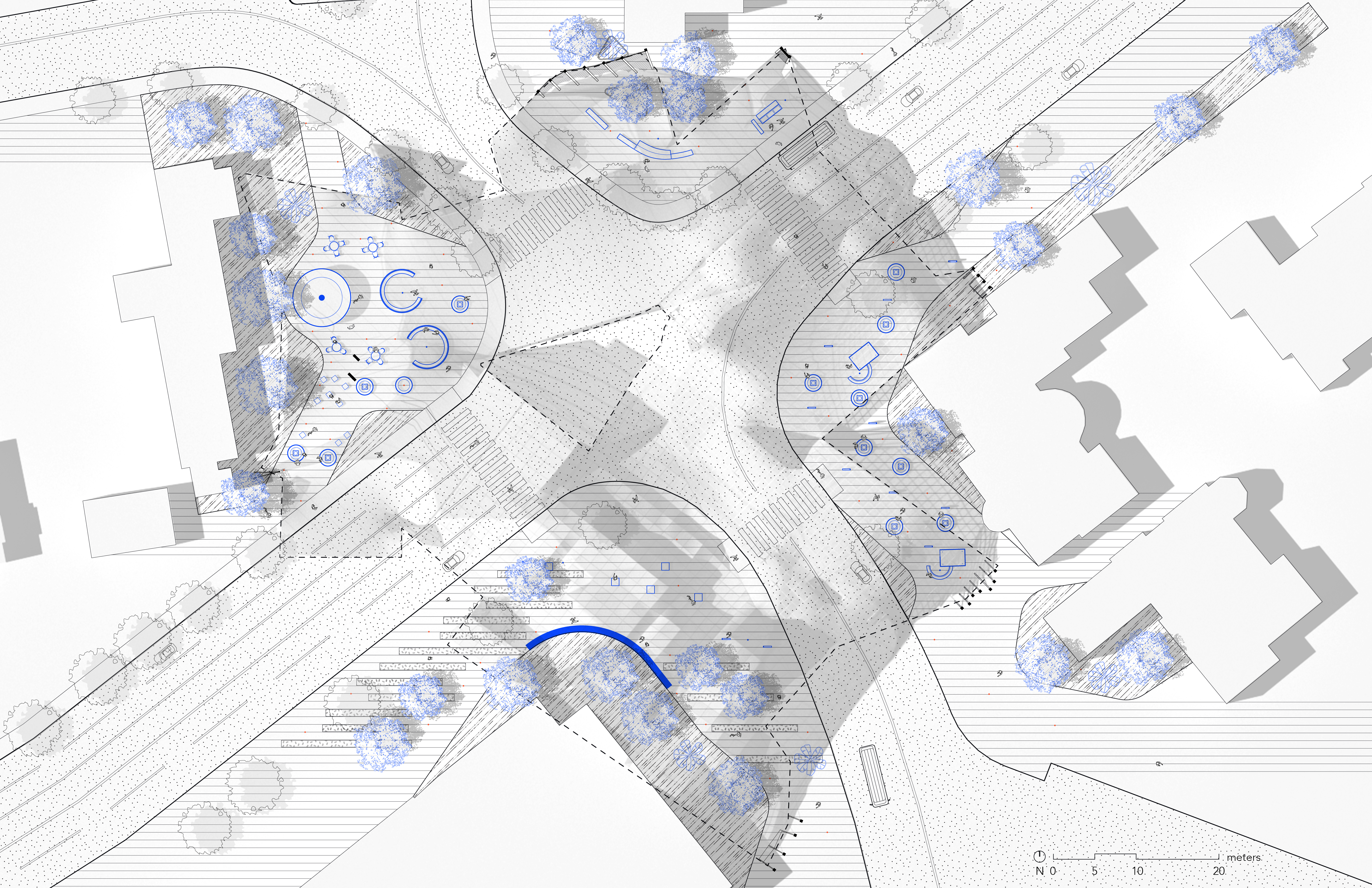
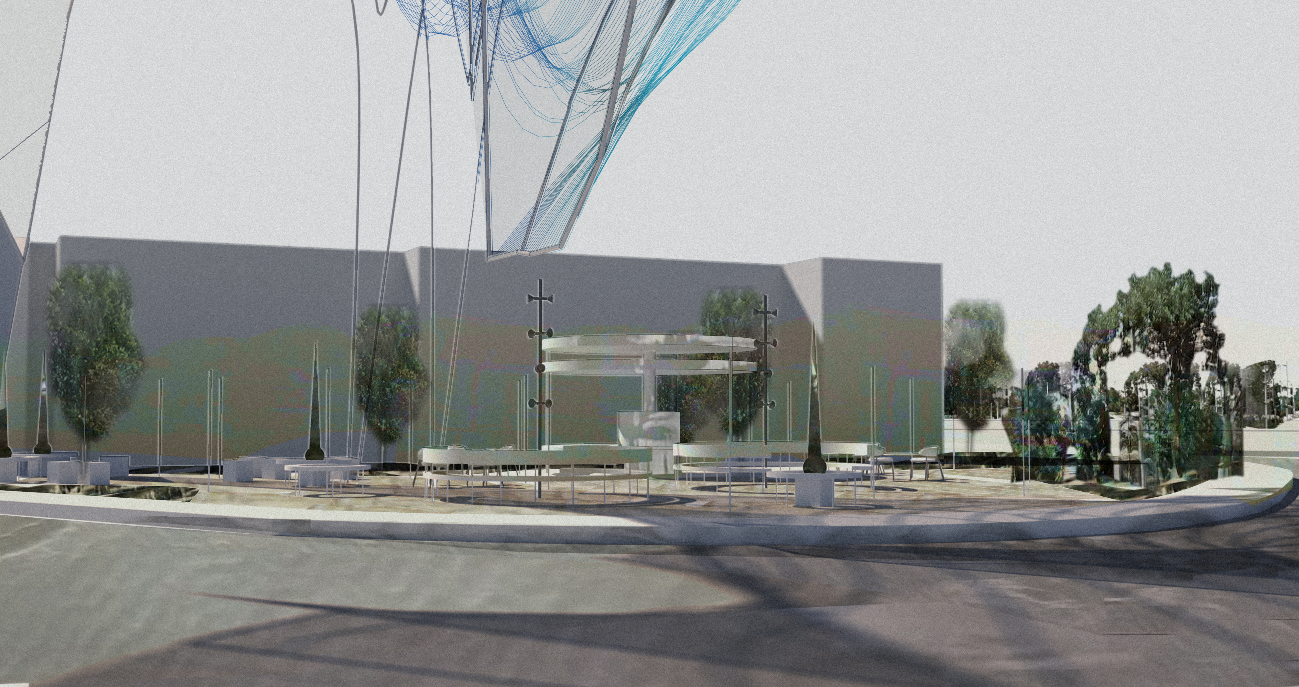
The project takes UCLA campus entrance, located along Sunset BLVD, as a prototype for the experiement of shading up LA and bridging over the boundaries of different neighborhoods, population, and ownerships. It is a new gate introducing people into this interesting transition from quiet and wealthy residential neighborhood, Bel Air and Westwood, to the dynamic public university campus life. The methodology hopefully can be deployed on other parts of Sunset BLVD and the city, creating the juxtaposition between neighborhoods, ownerships, classes and population groups, blurring the boundaries, changing the rupture conditions, bringing the shade and abundant resources to the public realm, and extending the dynamics to the underused places along Sunset Blvd.
“Ruptures”
there are many ruptures and unexpected sudden changes along Sunset BLVD
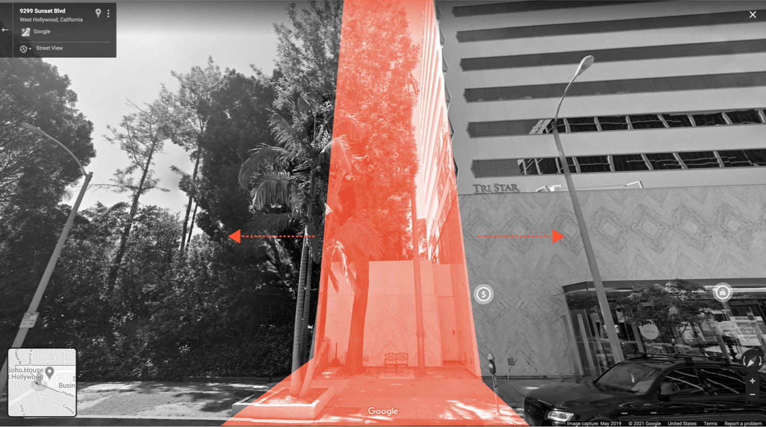
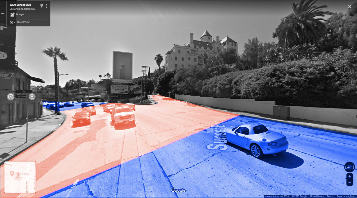
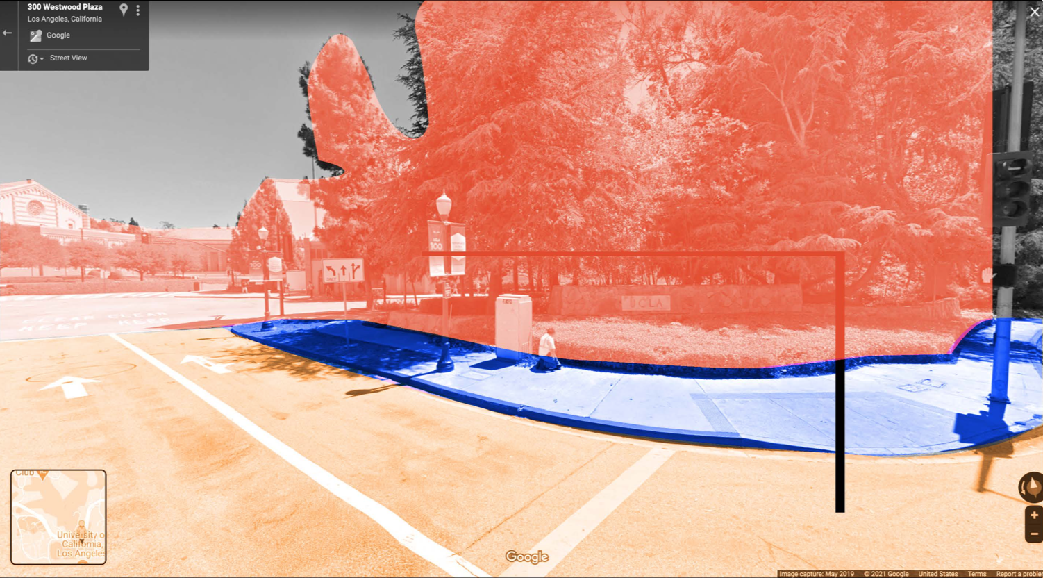
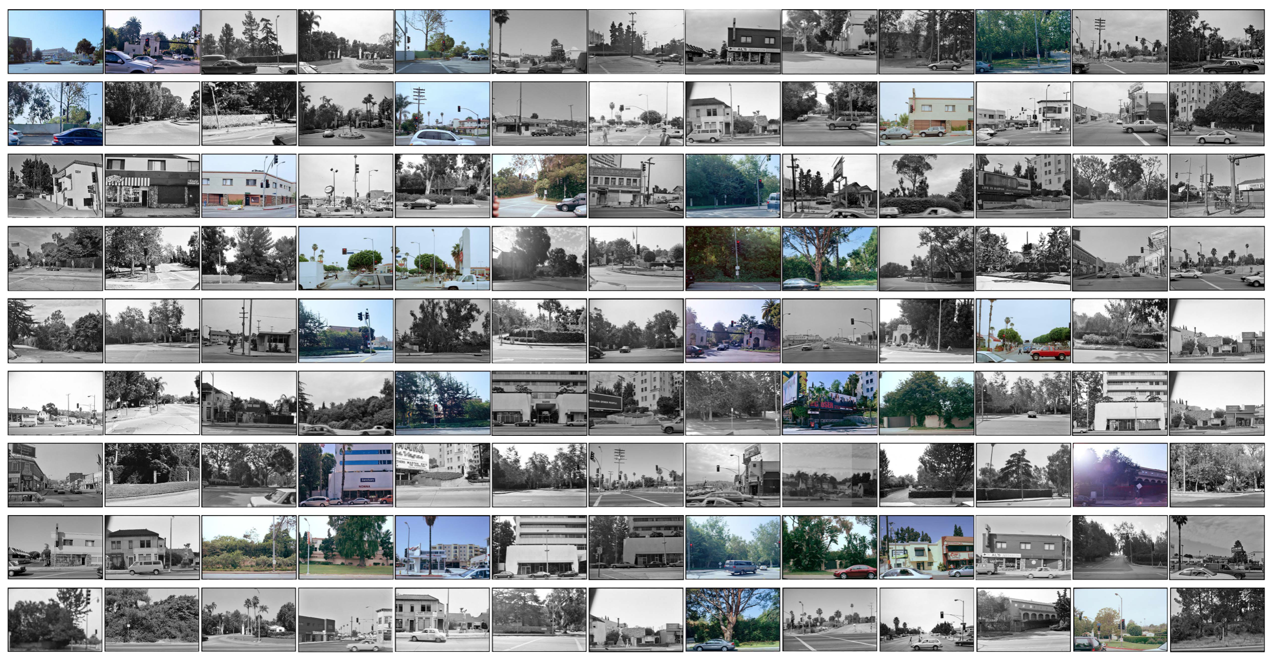
Ed Ruscha Curation
The Ruscha database for StyleGAN training is curated based on edge, rupture, and neighborhood locations within a 20-meter buffer zone.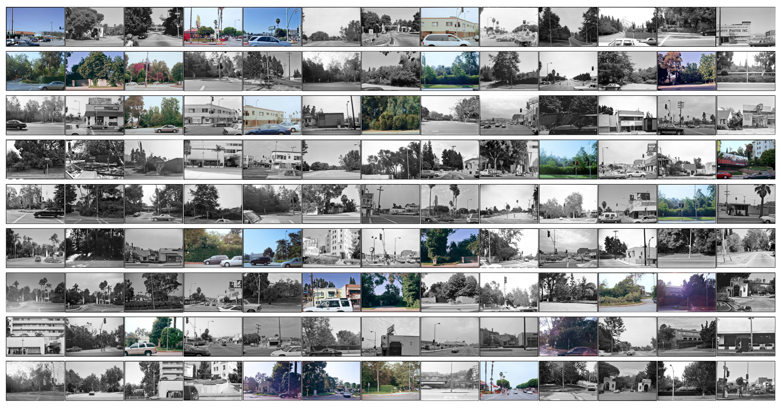

StyleGAN: Latent Space Study
how does the machine imagine the space to be? 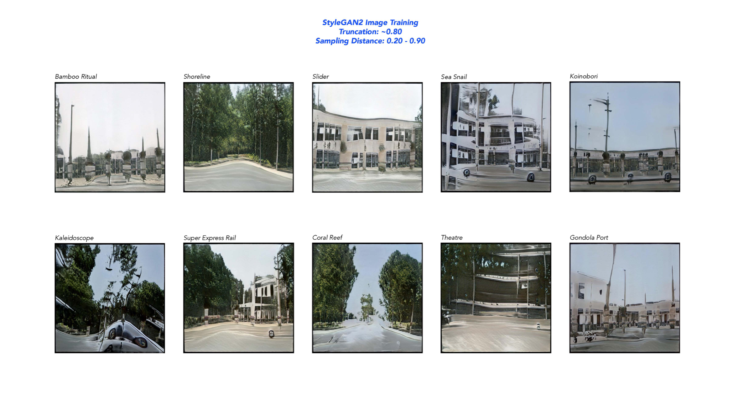
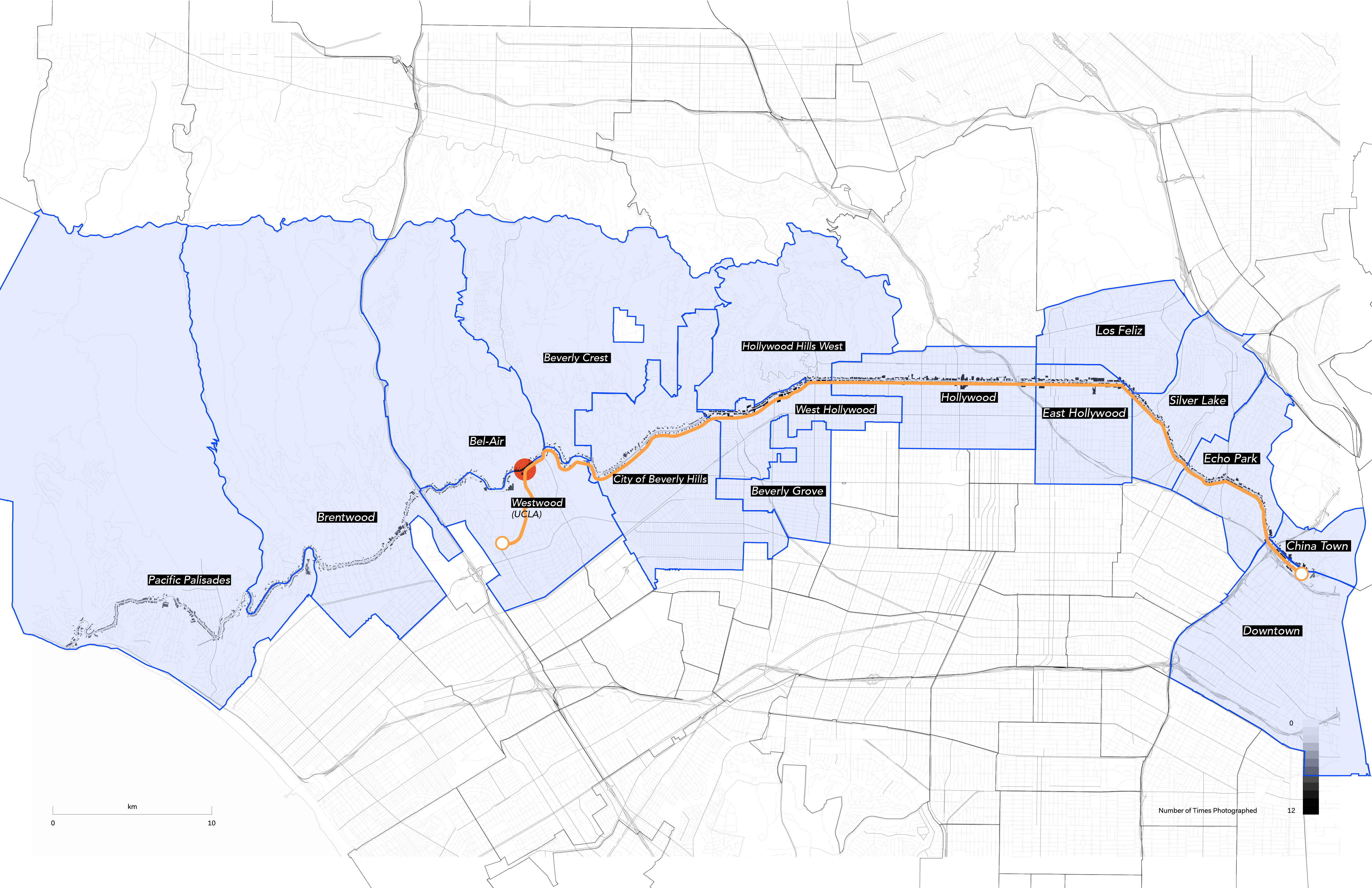
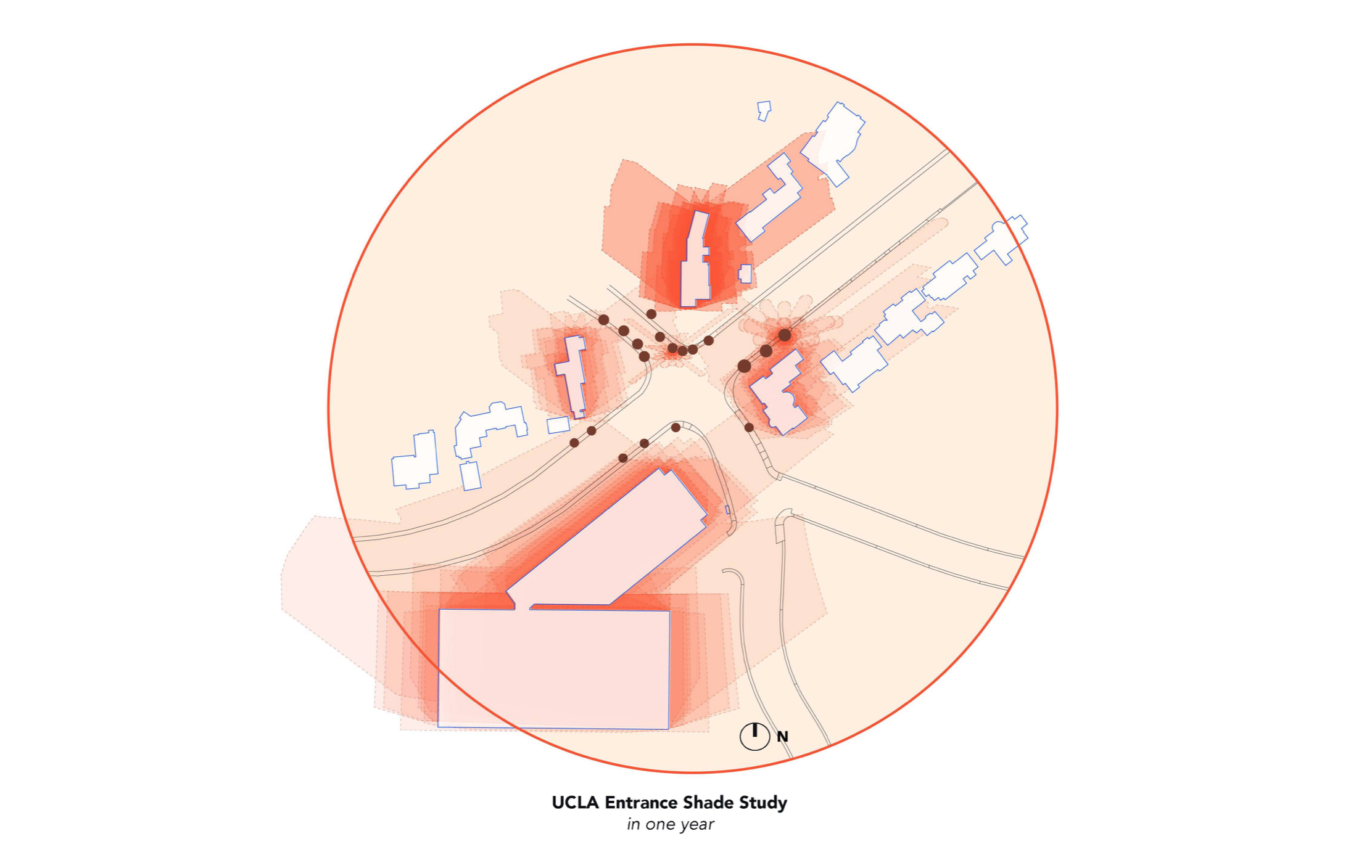
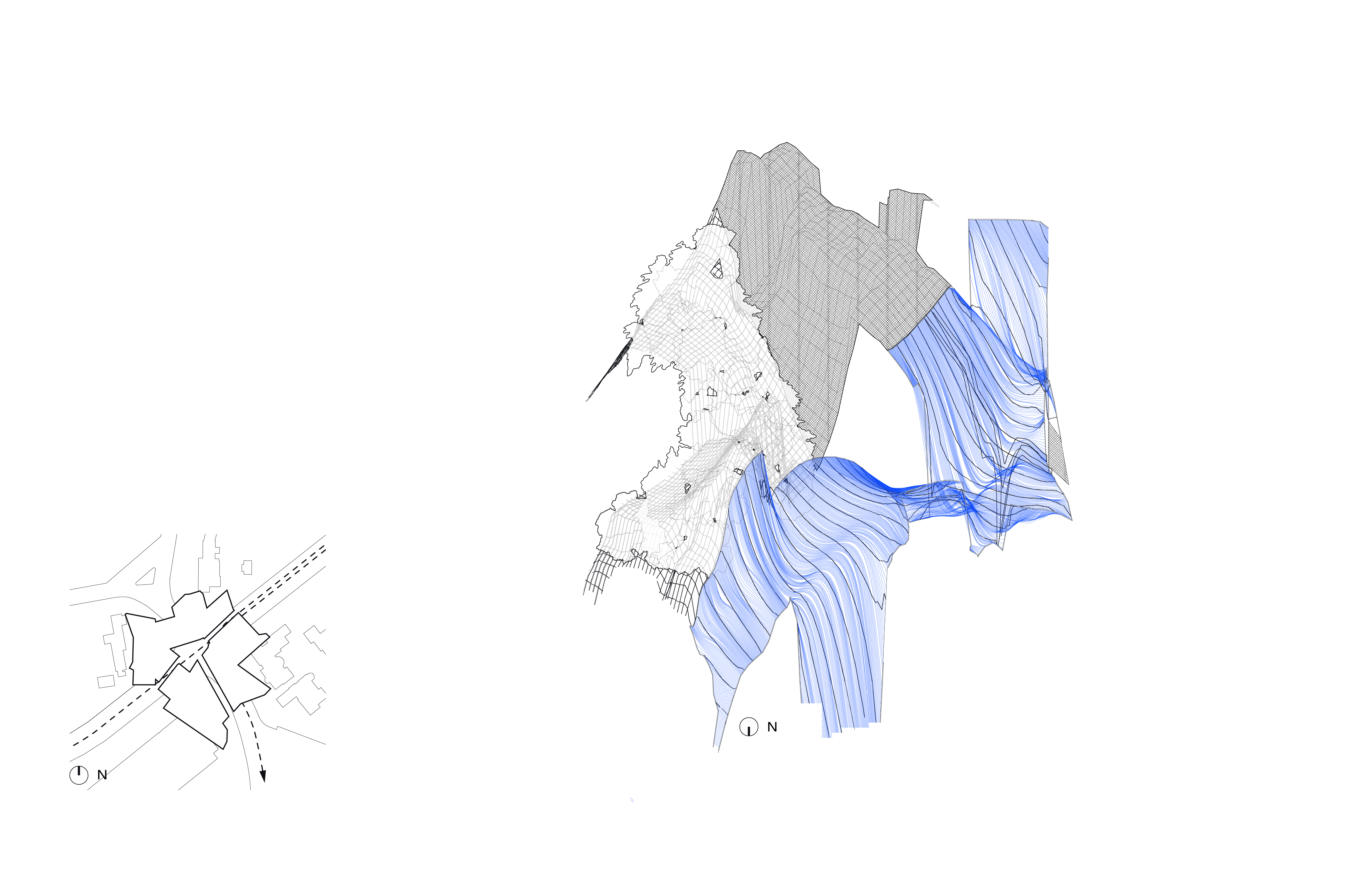
Pilot Site Map
UCLA Entrance34.078262, -118.439417

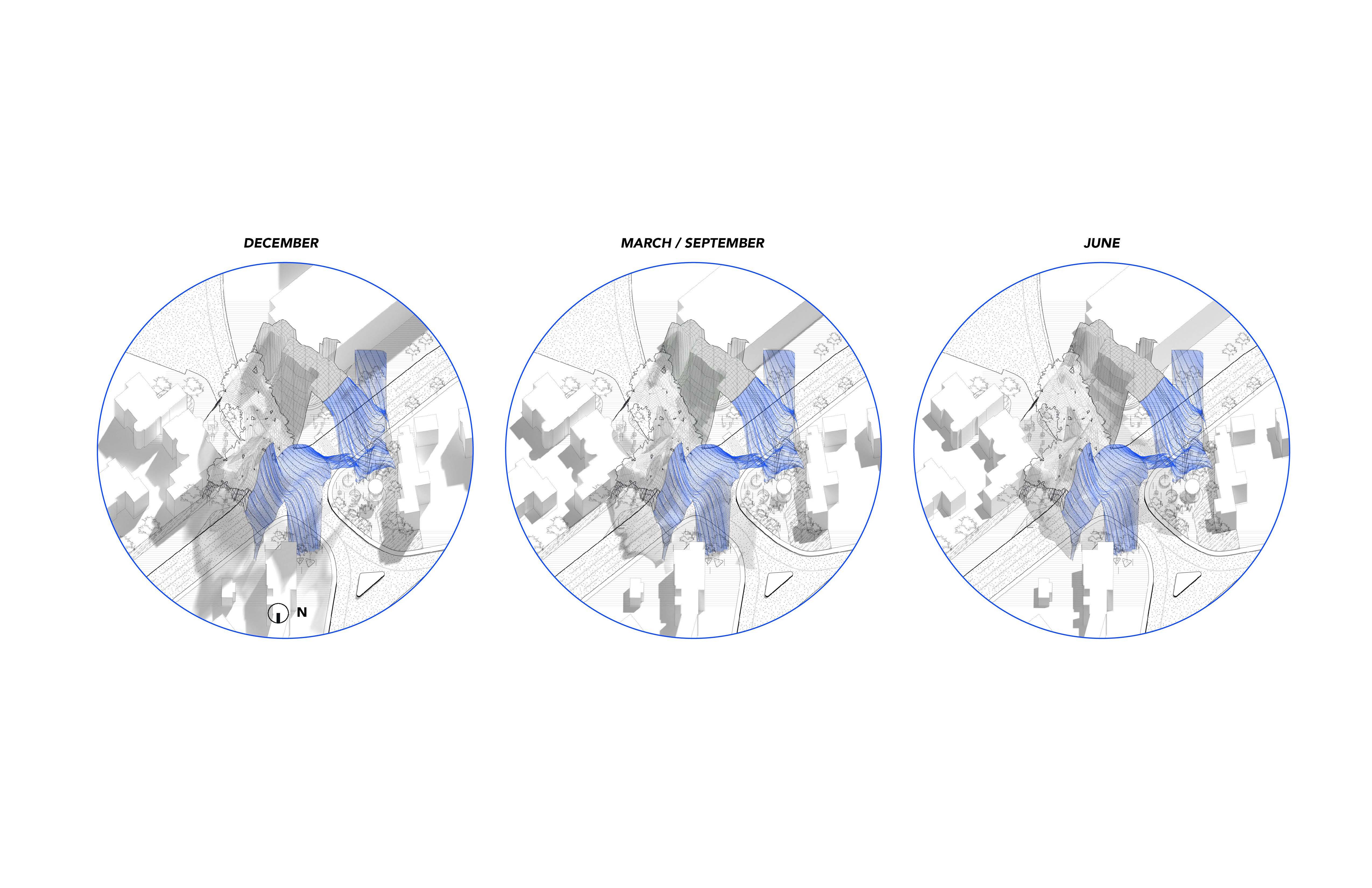
Site Shading Condition
![]()
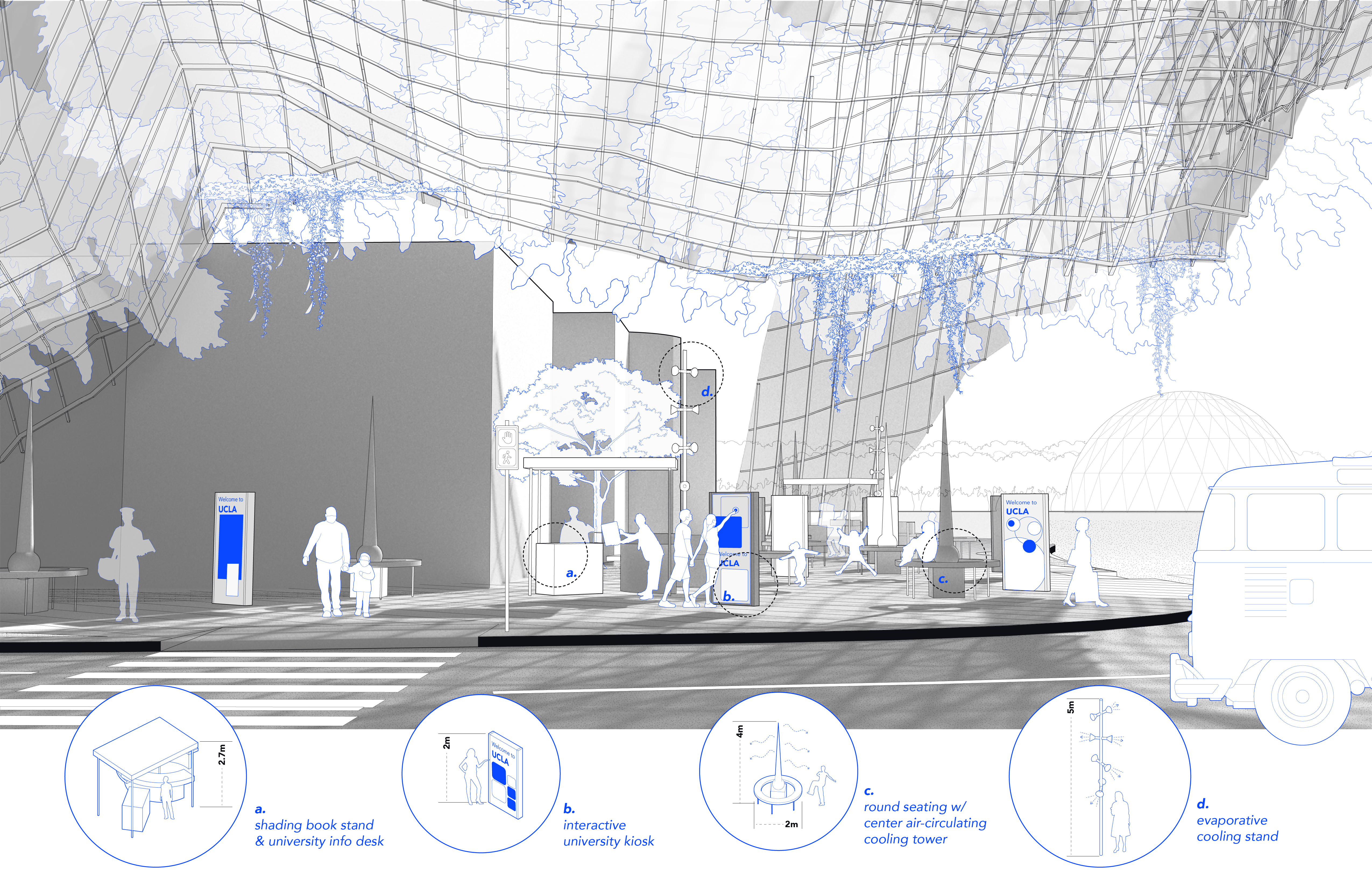
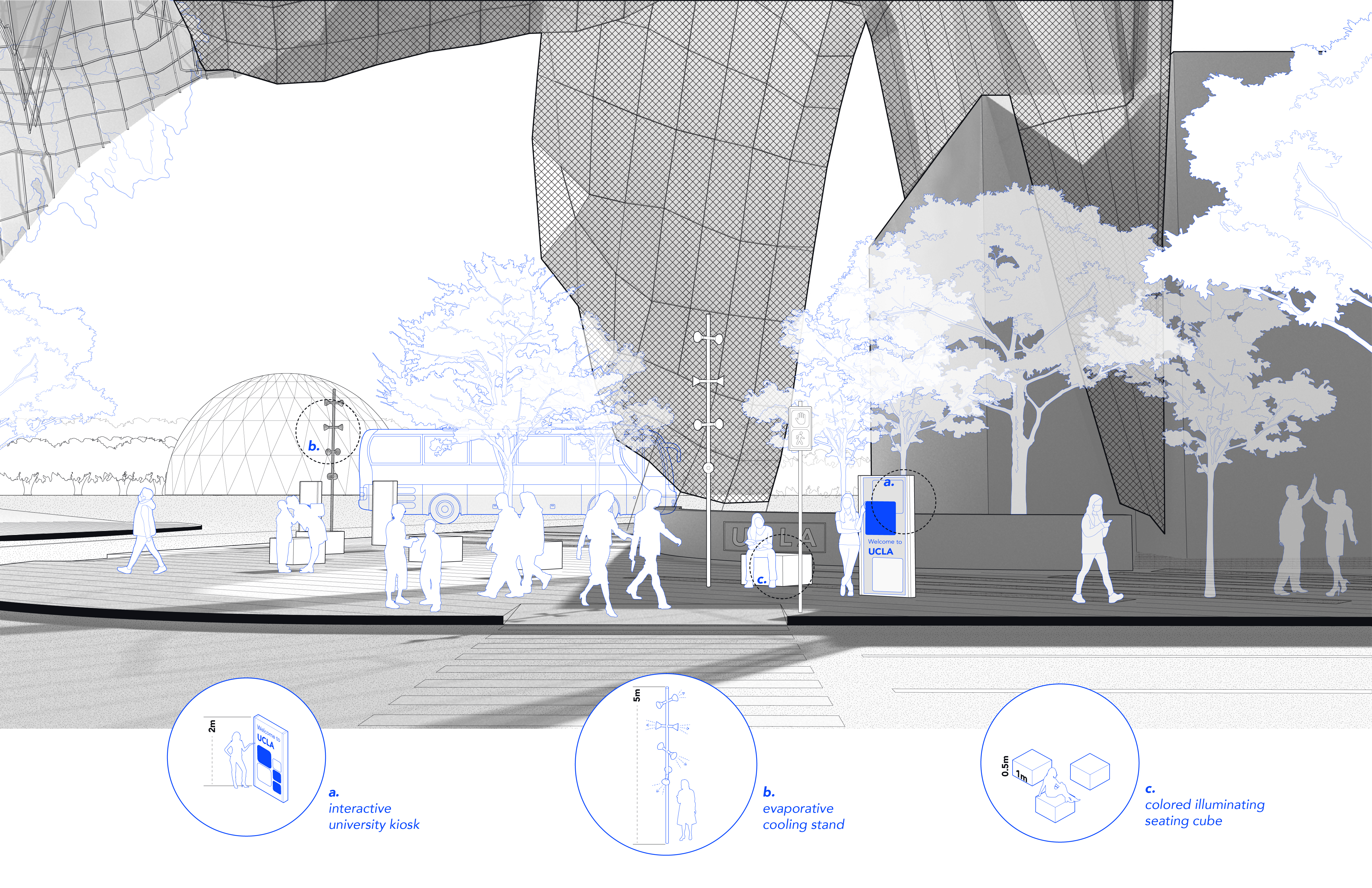
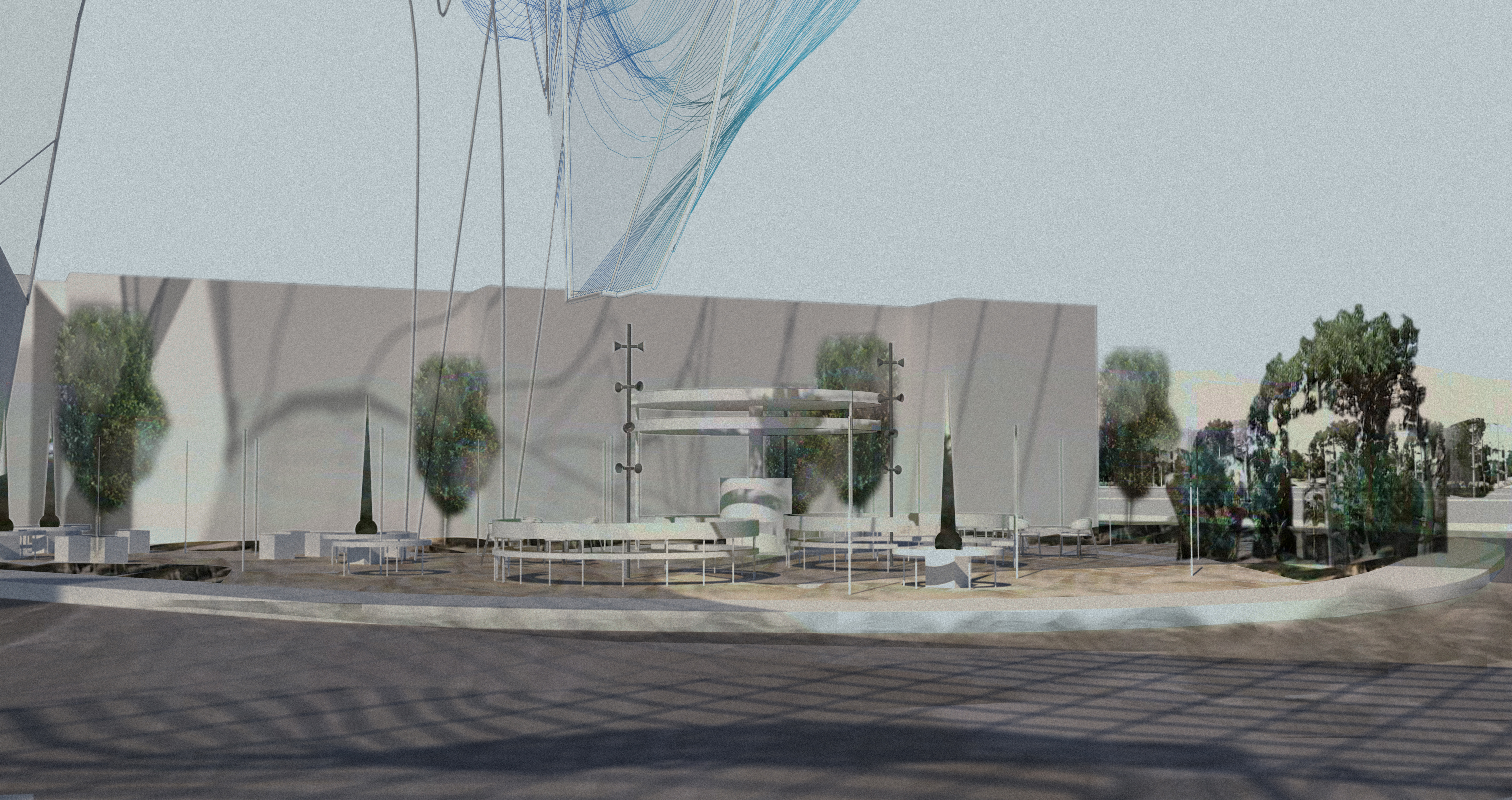
How Does It Work?
Computational MethodologyLatent Space Img ︎︎︎ Customized Grasshopper Script: img to depth map to 3D ︎︎︎ Spatial Design
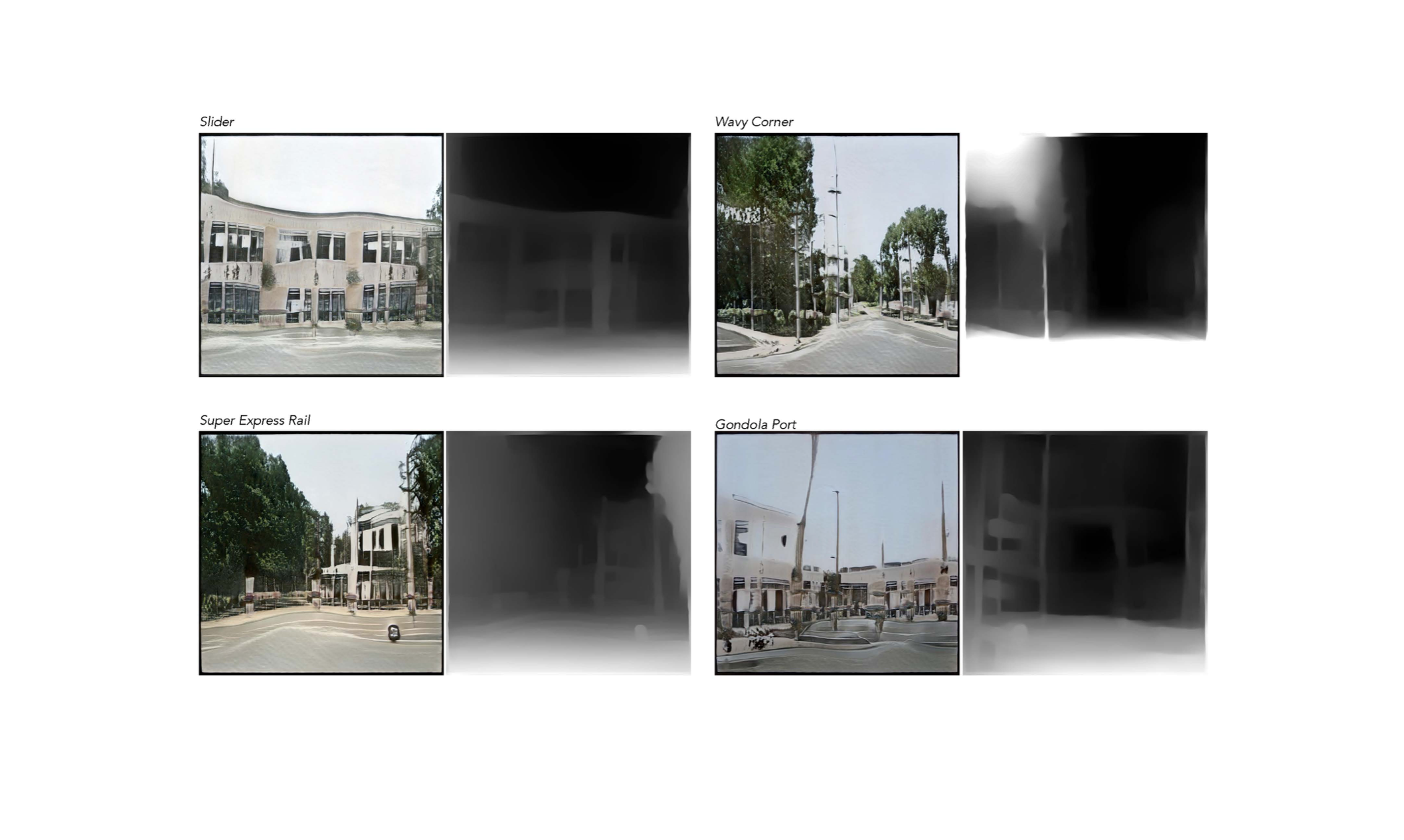
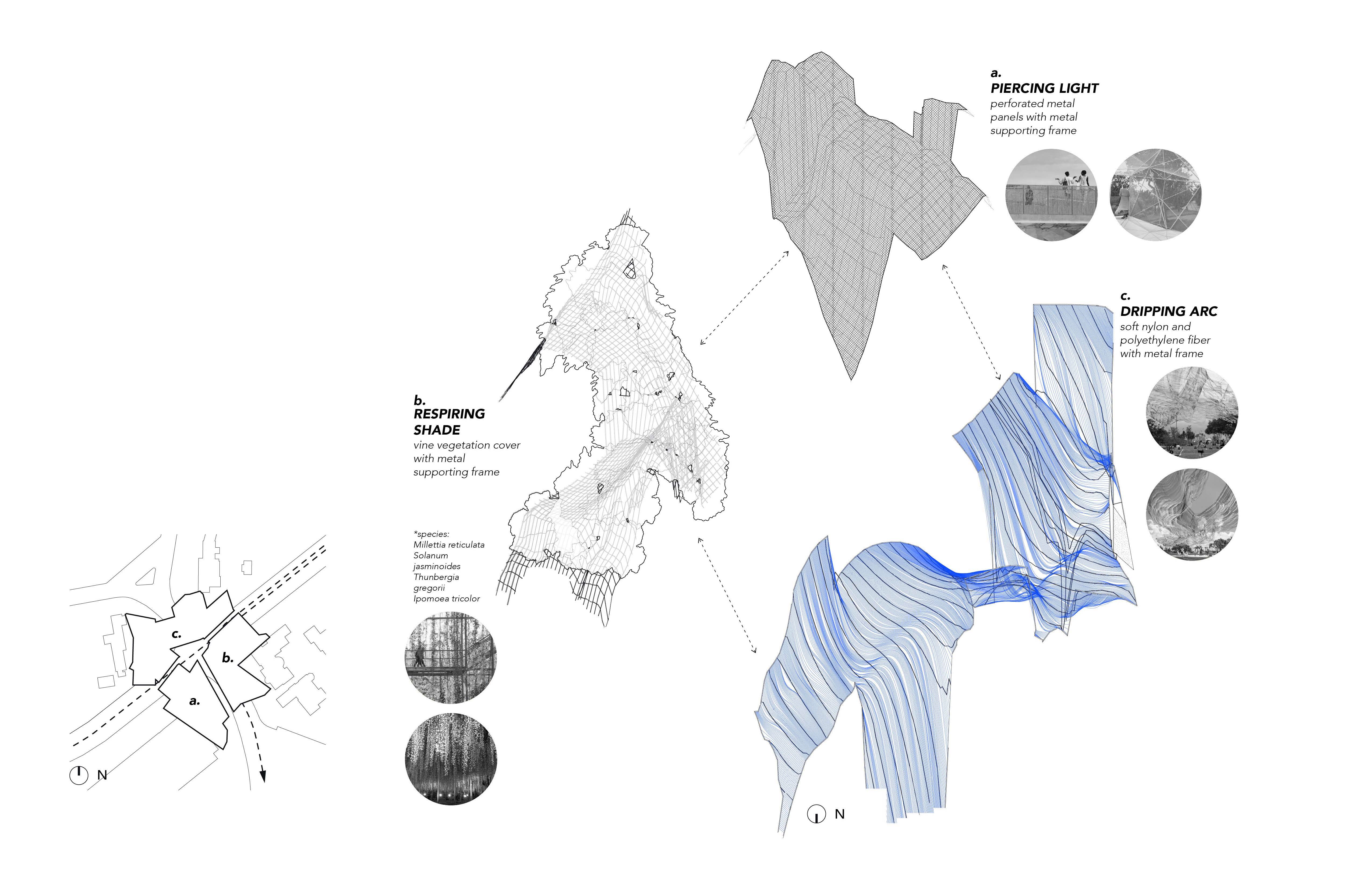
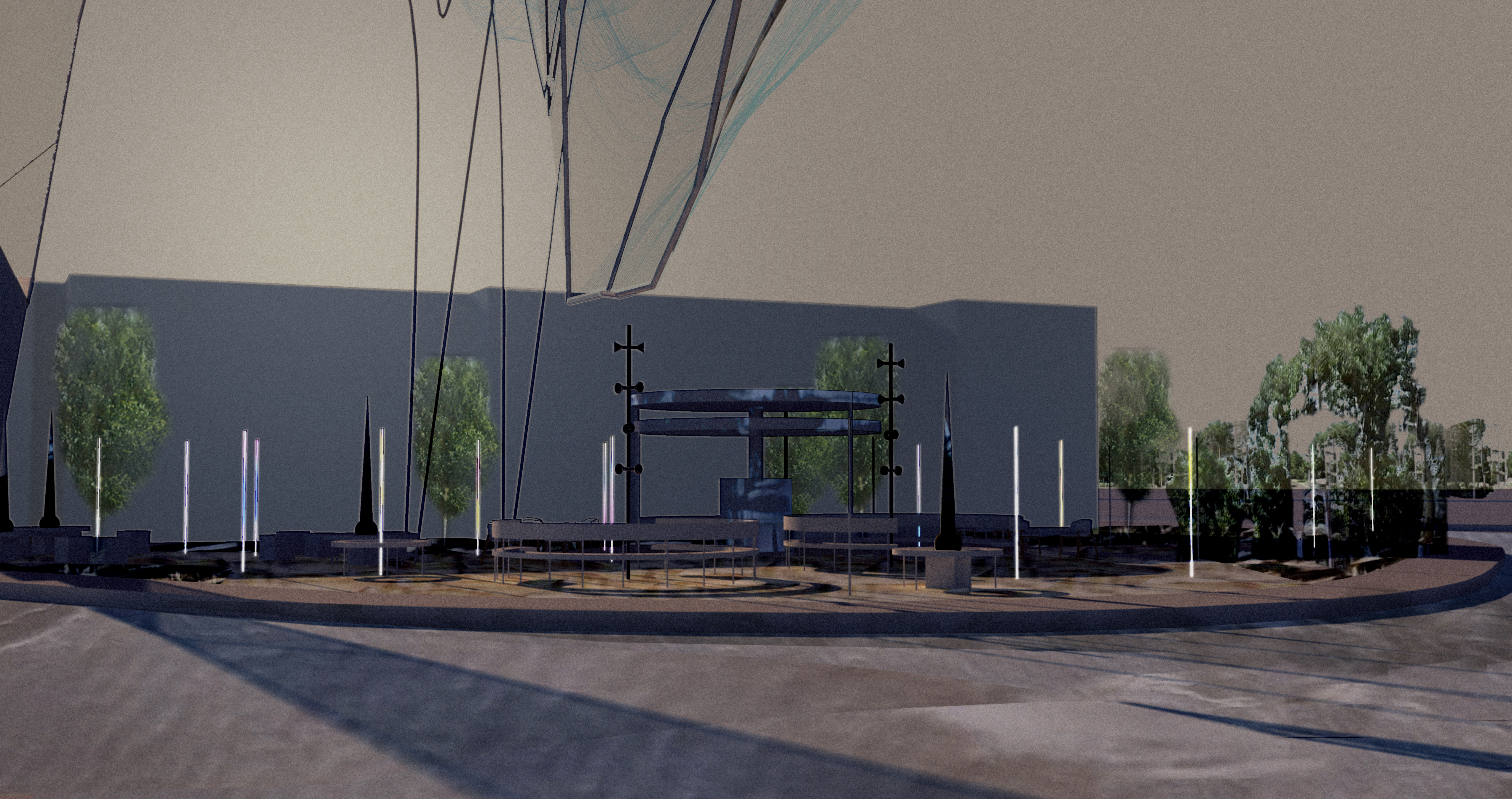
Design Outcome


...Another Round of Machine Hallucination

Don’t leave right away! Here are my two cents...
This was an early project testing how we can involve AI and machine minds into design process, during which I struggled a long time pursuading myself on the necessity of AI infultration. While I chose the topic of this project to focus on the social and physical raptures of neighborhoods, ironically, I felt the huge rapture between design and technology along the way and had a hard time build the logic and connection between machine generated visual and tangible and meaningful design outcomes. Why would we necessarily use it? Where do we draw the line between human intellegence and machine minds? Does the technology, if we don’t understand them fully and will always be far from understand them fully, create burden on unlocking design potentials?
After two years of industry work, and tested in-house AI generative tools for rounds in projects, I now feel comfortable to incorporate it as part of my life, a little bit more - not being emotionally attacked by it dragging me along the design process, but turning it into an additional tool and assistant to accelerate work efficiency. There is never a singular, flawless solution to a design problem, and it's important to remember that we are not in competition with one another - here I mean, us and machines.